On the Road, Tourist, Traveling, Uncategorized, United States

Wild. Wonderful. Wyoming

I’m a sucker for a diorama. Always have been. Maybe it was those sugar eggs we got at Easter with the little scenes inside, or an over-eager grade school homework project  that did it, I don’t know. Maybe I just like how life looks, all laid out for view in a tidy defined box. Whatever it is, it’s stuck with me. So when I pulled into the Southeast Welcome Center on I-25 outside Cheyenne, Wyoming and perused the brochures to see what might be found in Casper, where I was headed for the night, it is no surprise that the flyer for the Fort Caspar History Museum caught my eye.  And it didn’t disappoint.

Captain's letter awaits an envelope

Captain’s letter awaits an envelope

The museum is on the site of Fort Caspar, and the remaining buildings – officer’s quarters, the mess, the store and stables – have been restored and stocked and they sit away from the main museum site, so when you stand there, wind blowing up from the Platte, sun bearing down on an early fall day, squash ripening in the fort garden, you can *almost* sense what came before you, quiet, isolated. Blue coats, sabers, and captain’s hats adorn the bunks, checker and card games are laid out on communal tables next to tin mugs, ready for rowdy players and beer. A telegraph machine waits for news on a table in its own cabin. Off to the side, a Mormon Ferry buggy stands proud. Diorama, real-size.

Soldiers quarters in the mess

Soldiers quarters in the mess

Telegraph table.

Telegraph table

Inside the museum, the history of Wyoming has been lovingly recreated in one diorama after another. A display of stone tools through different eras of history outlines changes in the land and the people, new kinds of stone, new types of tools, arrival of Europeans. Around it, in wood and clay, miniature native Americans hunt mammoth, hunt buffalo, build teepees, fend off Europeans, and then attack them. Men and horses fall in gory fashion, red-painted blood oozing from their detailed clay bodies. It’s miniature America in all her glory.

Miniature America, in all her glory

Miniature America, in all her glory

Wyoming is full of little treasures like this: pieces of history that have been picked up, cleaned off, embellished and put on display. I skipped three other museums in Casper in favor of getting back on the road to Bozeman, and didn’t even touch on others that are sprinkled along drivable routes across the state. Maybe it’s the benefit of oil dollars, though neither Fort Caspar nor the Welcome Center itself (which had a historical display, including a dinosaur skeleton and a number of dioramas) glossed over the boom and bust effect of the industry, that fund all these little gems.

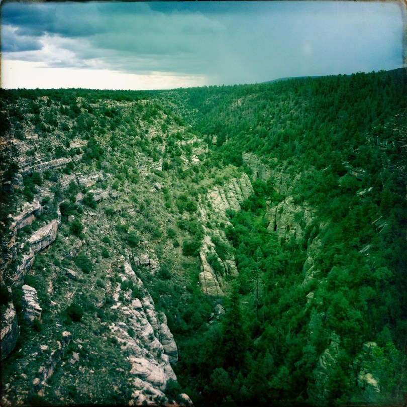
And what would be the point in hiding this ugly truth? You can see it in the life-sized diorama of scenery that is Wyoming itself as the land goes by. Towns like Story, Buffalo, and Bar Nunn pulling you off into the distance of gas-scarred hillsides. Mule deer and cattle graze side by side on rolling grass-spotted hills and mesas, hiding between rock skyscrapers, divided by snow fences, waiting for winter.

Wyoming rolling by

Wyoming rolling by

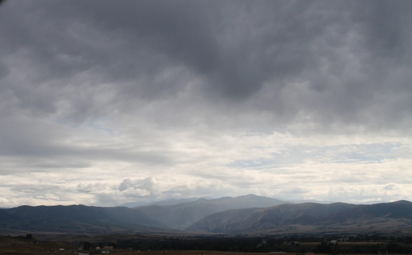
You feel the state in your bones as you drive it: riverbeds of cottonwoods changing colors and hardly another tree in sight except on the distant jagged mountains.  Red rock, granite, trains winding through. The Crazy Woman river running across it, running through you as you drive by. Wyoming. Wild. Windy. Wonderful Wyoming.

Sun after the rain on I-25

Sun after the rain on I-25

Wild. Wonderful. Wyoming.

Wild. Wonderful. Wyoming.

On the Road, Uncategorized

Are YOU My Cemetery?

Sea Stacks in Bandon

I’m chasing my ancestors down the path of their history, backwards through the towns they settled along highway 42 in Oregon. The route wraps around the south side of the Coquille river, starting with the warm fog that twists its way around sea stacks in Bandon and heads into Pleasant Valley, where the sun blinks through overcast skies.

My goal is to visit the graves of my grandmother and her family before tearing north on I-5 to make the 9 pm ferry for the San Juan Islands. But a 20-year absence from this part of the country and a couple well-placed questions from my mother have got me reinventing that kids book I used to read in kindergarten, “Are You My Mother?” Instead of a bird asking every living animal or machine if I belong to it, I’m a human screeching off the highway every time I see a sign for a cemetery.

“Are YOU my cemetery,” I asked this morning, after taking a hard left and tiptoeing through the remains of Coquille, to arrive at the Masonic Cemetery. Coquille’s main street looks like a movie set – a stately bank, sculpted storefronts, and too many empty windows in front of which few people move.  The cemetery is so small and non-descript I couldn’t believe the Masons claim it. I u-turned illegally in front of the high school marquee announcing registration dates and head back to 42, conspicuous in my dirty black foreign wagon with the Texas plates.

“Are YOU my cemetery,” I asked again, outside Coquille, when a cemetery sign pointed up a small hill to the Myrtle Crest Memorial Gardens. The hill and quiet atmosphere were promising, but the cemetery was new and compact, one small loop of road with grave markers on either side, and four groundsmen tending to the sprinkler system. One moved his truck out of the one lane so I could get by without running over the dead, and while I headed back down the hill I thought it must be true what they say: the only two things you can count on are death and taxes, and the death part is an increasing certainty in this part of the country, where the land is what you count on, and there isn’t much else.

View of Pleasant Valley from Norway Cemetery

In my memory, at least, MY cemetery sits high on a hill with a view of the valley and a two lane road winding beneath it. There are pine trees, and graves from the last century, and an A&W not far down the road. I remember thinking the last time I was here that this wouldn’t be such a bad place to spend eternity. But things have changed. The winding two lane road is now a six lane arterial, and the town of Norway, which I believe is where MY cemetery is located, doesn’t show up on my iphone map. Still, the road winds on. To the left, hills rise and fall, and to the right, the valley lies down, throwing up a lumber mill, new or abandoned, or a dairy farm, from time to time.

The Chandlier Drive-Thru Tree

They know what they are doing here, and they’ve been doing it for more than a century. Sheep and cattle graze the flat lands, timber is cultivated and felled on the mountains, and milled beside the busier transport roads. Always, trees are left bundled and tall along the most visible pathways, as if the pine curtain can hide a naked mountain of clear cut, or the low bush where trees begin to grow back, only to be cut again in how many years? 40? 50? Nothing will replace those that came down a century ago – like the ones along the Avenue of the Giants I drove yesterday on my way up California. There are no more “Drive Thru Trees” being grown, no more “One Log House.”

Mechanical memories of yesteryear

Mechanical memories of yesteryear

While I am gaping yet again at a truck cab speeding past, hauling his own back half on his mid section, the empty hitch and fork of a logging truck without the load, I see another cemetery sign out the corner of my right eye. As it registers, the turn-off passes on the left, blurred by the roadside leftovers dancing in the wake of the Mac cab. I take the next opportunity to pull off the main drag and circle back on old 42, slow, narrow, littered with mechanical memories of yesteryear. This is the southern Oregon I remember. This is my America.

Welcome to Norway Cemetery

I miss twice before making the turn. The new road is up ten feet higher than the old one. To get up the cemetery hill, you must first go down into a rut. “Historic Norway Cemetery,” the sign welcomes. Then validates, “circa 1875.” My grandmother and great aunts, their parents and aunts and uncles are where they were left.  The view is little changed, though the trees slightly overgrown. A lone gardener tends to some of the grave sites.

I sit with my family, have my communion with the dead. The dog chooses my great-great uncle’s stone as a cool place to lay his head on a heating day. I update everyone on my sisters, my niece and nephews, who looks like whom and acts like who else. I sit in silence and look at the valley, then wander around the gravesites of pioneers. And then I head out, communion finished, twist back down  to the new 42, and speed past the A&W to head north.

IMG_3039

On the Road, Tourist, Traveling

Walnut Canyon

IMG_2397It looks like nothing coming in: a highway exit outside of Flagstaff, a quick sharp turn and the road becomes small, quiet. High, arid mountain scenery. Smell of rain coming in. You get out of your car, walk to the edge, and it falls before you:  a  canyon of dripping limestone and piñon, layers of rock and earth weathered by wind and rain, striated by history.

Look  a little closer. You’ll see what they saw, the Sinagua, who lived here for more than a century, over seven centuries ago. You’ll see crevices that could become home, protect you from wind, hold the heat of a hearth fire. You’ll see the river water below, dirt that could become clay, that could become bricks to build houses in the high-walled world. The view of the eagles, to keep watch. Plant life so diverse it is unrivaled elsewhere in the valley.  And so you build.

IMG_2315Down the 185 steps from the ranger station, the canyon is so quiet you can hear a child sigh from the far end of the trail. You can hear your own breath as it stumbles from your lungs, unaccustomed to the 6,700-foot elevation. You can smell, on the warm wind, the black walnut in the creek bed below, and when you look down to find the source, you’ll find instead a hawk, lumbering below you, working his way up on the current, until he soars above your head, and still beneath the canyon ceiling.

You can duck into the empty houses tucked into the wall and stare at the residue of hearthfire smoke on the ceiling, and wonder what it was like to live here. And while tucked in this studio apartment that used to house a family, you’ll look across the canyon and realize those striations you see in the rock, half of them are filled with homes just like this one, scattered across the area. If there were still families here, you could holler to your cross-canyon neighbor to borrow a cup of sugar.

crop flowerNo one really knows what caused the Sinagua to homestead in Walnut Canyon, or why they left.  The name itself is a misnomer:  these are native peoples, not speakers of Spanish. Here, just as at Montezuma’s Castle and Tuzigoot, the settlements aren’t far from water. Though climbing more than thirty stories of steps to carry it isn’t ideal, the safety gained from living in an almost imperceptible hole in a rock is worth the effort.

Sinagua settlements up and down the Verde Valley, now mapped by Arizona Highway 17 running south from Flagstaff to Phoenix, all share this same mysterious fate: their development appears at various times, and then they are deserted. Some groups, like those at Montezuma’s Castle, stayed more than four hundred years. Others didn’t last.  Around 1250 AD, after less than 200 years of habitation, Walnut Canyon was abandoned, leaving behind evidence of ample, healthy trade with people as far away as Central America, but no reason for departure. Hopi legend claims the Sinagua as an origin people of their own. Other theories say the Yavapai came and pushed out the Sinagua. Whatever the reason, they left , gifting us this trove of historic mystery in their wake.

IMG_2326

For more images of Walnut Canyon and Montezuma’s Castle, please visit the Ruins of the Southwest Gallery.